When Water Moves the Earth
Why pipelines are one of Mazarine Climate's four target sectors.
Tell someone who invests in climate adaptation that you spend time around pipeline operators and you get a pause. Pipelines read as the other side of the ledger — fossil infrastructure, the thing adaptation is adapting to. Tell someone from the water industry the same thing and you get a different pause. Pipelines carry oil and gas. Nothing about them is water.
Both reactions are reasonable from a distance. Both dissolve the moment you look at what actually takes a pipeline out of service.
A pipeline is a linear asset, thousands of miles long, that has to cross every river, creek, wetland, floodplain and unstable slope between its origin and its terminal. Most of it runs below ground. Some of it doesn't — aerial spans at water crossings, elevated runs on vertical supports through permafrost terrain, exposed sections at pump and compressor stations. Buried or above grade, the exposure is the same in kind: the asset cannot detour around bad ground the way a building can be sited away from it, and it cannot be relocated when conditions change. Its risk profile is a function of what water does to earth — and water is doing new things to earth.
Look at it through a hydroclimatic lens and the picture inverts. The largest operational headache a pipeline owner carries is not corrosion, not third-party strike, not politics. It is water moving ground.
What actually fails
The failure modes are specific, documented, and getting worse.
Scour and channel migration
Rivers move. They deepen during floods and they wander laterally across their floodplains. A pipe sitting safely beneath a riverbed becomes a pipe suspended in open current. In July 2011 an ExxonMobil line failed near Laurel, Montana, releasing 63,000 gallons of crude into the Yellowstone River; the federal investigation attributed the rupture to channel migration and riverbed scour that left a long span exposed to sustained current and to debris washing downstream. A railroad bridge and a highway bridge had constricted the river, driving the current to cut downward during spring flooding. Cleanup ran to roughly $135 million.
The same mechanism attacks above-grade crossings from the other direction, undermining bank supports and abutments until an aerial span loses its footing, or loading it with flood debris it was never designed to take.
The physics of exposure
Once the cover is gone, the current itself becomes the weapon. A month after the Yellowstone failure, an Enterprise line in the Missouri River in Iowa released 28,350 gallons of natural gasoline; metallurgy traced the rupture to fatigue cracking driven by vortex-shedding vibration in the pipe. The river doesn't have to strike the pipe. It only has to make it hum.
Rainfall-triggered slope failure
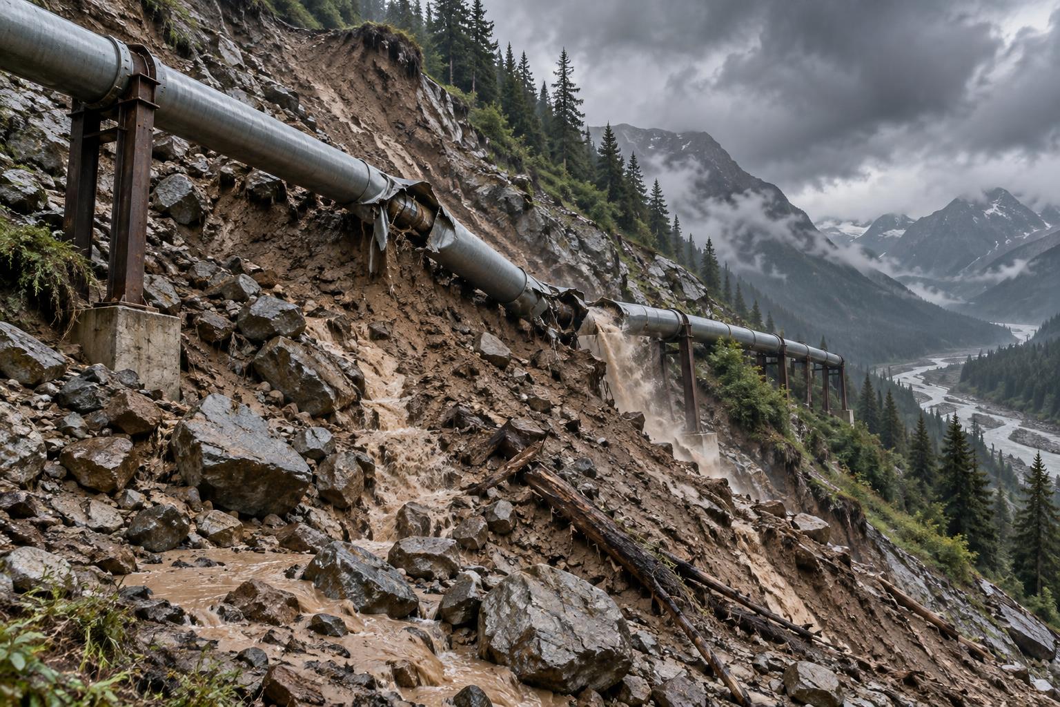
Saturated ground moves, and a pipeline crossing it moves with it. In November 2003 a retrogressive earthflow in sensitive glaciomarine muds at the Khyex River in British Columbia took out roughly 300 metres of an 8-inch Pacific Northern Gas line and left most of Prince Rupert without gas or heat for ten days. Not a spill story — a supply story. A regional population lost heat because a slope gave way.
Thaw and ground ice
In the north the ground is the foundation, and it is changing state. Thaw settlement pulls at buried pipe and at the vertical supports holding elevated pipe alike. On the Norman Wells line through the Mackenzie Valley, around 165 slopes were identified at design as needing modification against erosion or thaw, most of them approaches to stream crossings. Route studies along the Yukon–Alaska Highway corridor catalogued more than 2,000 geohazard features, including over 1,700 landslides, along a single 950-kilometre corridor. That is the density of the problem stated plainly.
And the rest of the family
Buoyancy and flotation where saturated soils lift pipe out of its trench. Washout of right-of-way and access roads, which turns a repairable failure into an unreachable one. Post-fire debris flows, where drought and fire hand the bill to the next rainstorm. Shrink-swell settlement in clay soils through drought-and-deluge cycles.
Different mechanisms, one driver. Water arriving in the wrong amount at the wrong speed, and earth responding.
You cannot move the network
Here is the sentence that makes this investable. These systems were engineered against a historical hydrology, and the record no longer predicts the next event. After the Yellowstone failure, Exxon had concluded the line was not at risk because past floods hadn't damaged it; regulators called that assumption 'not reasonable' and made the general point that the absence of damage in previous floods is no guarantee that future flooding cannot cause one. That is the entire adaptation argument in one regulatory finding. The past has stopped being evidence.
And you cannot rebuild thousands of miles of network against the new distribution. Replacement is possible at a handful of the worst crossings and nowhere near the rest. So the adaptation available to an operator is not steel. It is information — knowing which crossing, which slope, which segment, before the rainfall rather than after the failure.
The old model for getting that information was periodic survey, and it fails in exactly the way you'd predict. Bridger's Poplar line had been verified at eight feet of cover beneath the Yellowstone and was scheduled for a re-check five years out. Three and a half years later it was substantially exposed on the riverbed and leaking more than 30,000 gallons. About 120 feet of it lay bare. The survey wasn't wrong when it was taken. The interval was the vulnerability.
What replaces the interval
The replacement is a technology stack that has only become deployable in the last few years.
Satellite and InSAR: ground deformation, measuring millimetre-scale movement across an entire corridor rather than at inspection points.
Distributed fiber-optic sensing: strain and acoustics turning the pipe itself into the instrument.
In-line inspection with inertial measurement: detecting bending strain that indicates the ground has moved around the pipe.
Precipitation-threshold models: that convert a forecast into a segment-level alert, rather than a general warning.
High-resolution elevation and repeat LiDAR: for channel migration, bank erosion and slope change detection.
Geospatial AI: doing the triage: turning a corridor-wide worry into a ranked list of locations with a number attached to each.
That last point is where the value concentrates. No operator can instrument every crossing, and none needs to. The commercial problem is prioritisation — pointing a finite inspection and mitigation budget at the specific segments where the hazard is real this season. That is a software problem sitting on a sensing problem, which is precisely the layer we invest in.
The buyer is compelled. Not by sentiment or a sustainability budget, but by integrity-management obligation, by regulators who now expect documented geohazard programs, by insurers, and by a loss profile where a single crossing failure clears nine figures once cleanup, fines and downtime are totalled. Regulators didn't just fine the Poplar operator; they required the river crossings be rebuilt by horizontal directional drilling. That is what a compelled buyer looks like.
Why Calgary
Which brings us to next week. The International Pipeline Conference & Expo runs September 21–25 at the BMO Centre in Calgary, biennially, with 300-plus exhibitors across monitoring systems, robotics and AI-driven solutions.
It is not an investor conference, and that is the point. The people walking that floor are the asset owners who carry this risk on their balance sheets, the engineering firms who advise them, and the vendors already selling into the problem. For an early-stage fund, three things are available in that room that are available almost nowhere else: a straight answer on whether a customer will actually pay, a live map of what has already been commercialised and where the gap still sits, and early acquaintance with the strategic acquirers our portfolio companies will eventually sell to.
Calgary is also the right geography for the hardest version of the problem — northern corridors where scour, slope instability and thawing ground ice compound along the same right-of-way.
Invisible from both directions
We are bullish here for a reason that has nothing to do with contrarianism for its own sake. This category is genuinely hard to see from either side that ought to be looking at it.
Adaptation investors miss it because the asset reads as fossil energy. The politics are inconvenient, so the sector never makes the shortlist, and adaptation capital drifts instead toward the visible public-facing assets — cities, coastlines, agriculture — where the story is easier to tell. Meanwhile the water industry misses it entirely. The buyer is not a utility, the asset carries no water, the procurement happens nowhere near a water conference, and nothing in the vocabulary of stewardship or supply applies.
And here is the tell: the operators themselves don't use the word water. They say geohazard. Integrity management. Depth of cover. Scour. Ground movement. The category is fully formed, professionally staffed, technically sophisticated and well funded — and it is filed under a name that neither adjacent investment community searches for.
That gap is the opportunity. In our bottom-up build, linear assets run from roughly $11B of hydroclimatic risk technology spend in 2024 to $27B by 2030, at a 16.2% CAGR, with the heaviest sensing weighting of any of our four sectors. That weighting is pipelines and their peers — assets you cannot move, monitored continuously because they cannot be monitored any other way.
We don't invest in water. We invest in what it threatens. On a pipeline system, what water threatens runs continuously for a thousand miles and crosses every river in its path.
Building for assets that cannot move?
Mazarine Climate backs companies that turn hydroclimatic risk into priced, asset-level decisions for linear assets, coasts, F.I.R.E. infrastructure, and power generation. Read our thesis, explore our sectors, or get in touch.